1/3


Red Palm Weevil Mobile
1K+Λήψεις
4MBΜέγεθος
1.1(10-10-2020)
ΛεπτομέρειεςΑξιολογήσειςInfo
1/3

Περιγραφή του Red Palm Weevil Mobile
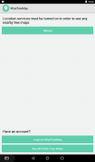
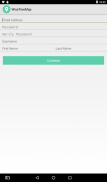
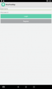
WiseTreeMap is a collaborative platform for plant inventory, tree location (invasive, threatened, infected..) ecosystem services calculation, urban forestry analysis and community participation.
WiseTreeMap platform can be used to identify and locate palms infected with red weevil.
-> follow-up of cases and planning actions
-> interaction and sharing on social networks for awareness
-> Filter species on tree characteristics and localization
-> Editing added trees (photo ..)
-> Ecological profit calculation for each tree
Red Palm Weevil Mobile - Έκδοση 1.1
(10-10-2020)Τι νέο υπάρχειRPW version
Red Palm Weevil Mobile - Πληροφορίες APK
Έκδοση APK: 1.1Πακέτο: com.hekma.wisetreemapΌνομα: Red Palm Weevil MobileΜέγεθος: 4 MBΛήψεις: 0Έκδοση : 1.1Ημερομηνία Κυκλοφορίας: 2023-01-20 19:33:28Ελάχιστη Οθόνη: SMALLΥποστηριζόμενα CPU:
Αναγνωριστικό Πακέτου: com.hekma.wisetreemapΥπογραφή SHA1: 44:43:FA:B2:10:2E:54:30:96:42:C3:B1:61:90:83:2E:F0:65:38:EDΠρογραμματιστής (CN): AndroidΟργανισμός (O): Google Inc.Τοποθεσία (L): Mountain ViewΧώρα (C): USΠολιτεία/Πόλη (ST): CaliforniaΑναγνωριστικό Πακέτου: com.hekma.wisetreemapΥπογραφή SHA1: 44:43:FA:B2:10:2E:54:30:96:42:C3:B1:61:90:83:2E:F0:65:38:EDΠρογραμματιστής (CN): AndroidΟργανισμός (O): Google Inc.Τοποθεσία (L): Mountain ViewΧώρα (C): USΠολιτεία/Πόλη (ST): California


